
Moab, UT
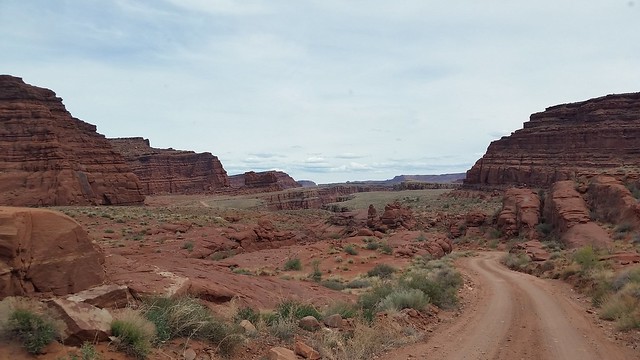
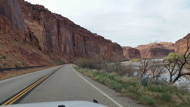
For our first adventure in the Moab area we decided to go up into Canyonlands National Park and hike the Lathrop trail. This section of Canyonlands, called Island in the Sky, is up on a huge mesa surrounded by steep canyon walls. To get up on the mesa we decided to take a scenic dirt route, Long Canyon Road, to the top. To get to Long Canyon Road we drove north on Rte. 191 and turned left on to Rte. 279, which runs right along the Colorado River on the left with a high cliff on the right.
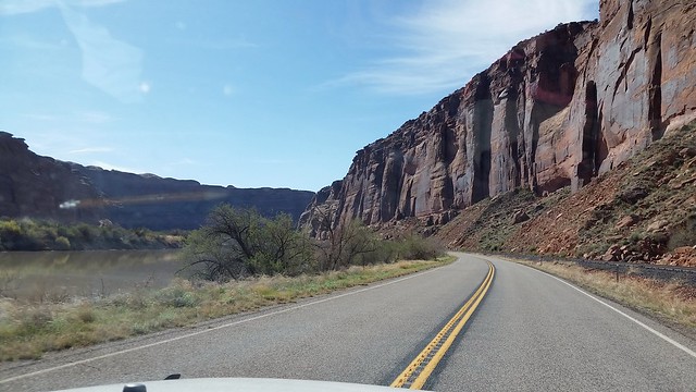
Along Rte. 279
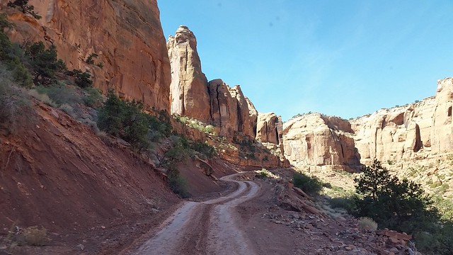
About 13 miles up Rte. 279 we turned right at the Jug Handle Arch on to Long Canyon Road.
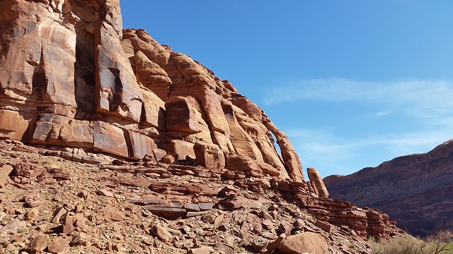
Jug Handle Arch
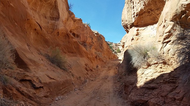
For the first two and a half miles the road is fairly smooth (for a dirt road) as it winds through the beautiful canyon.
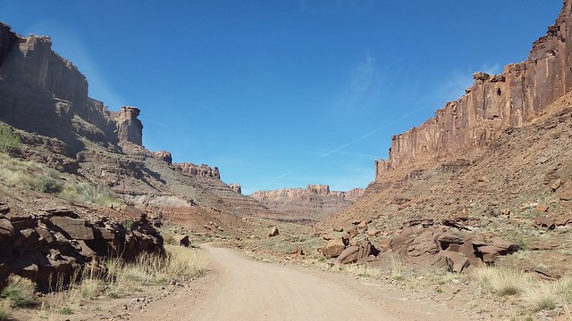
At that point the road begins to twist upward toward the mesa.
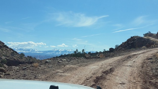
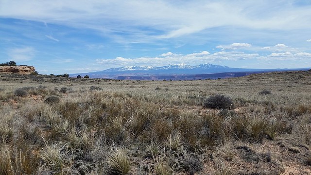
Looking back to the east the La Sal Mountains make for some great views.
Going up!
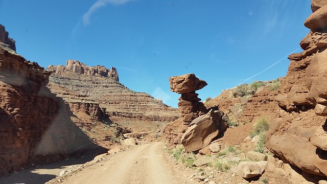
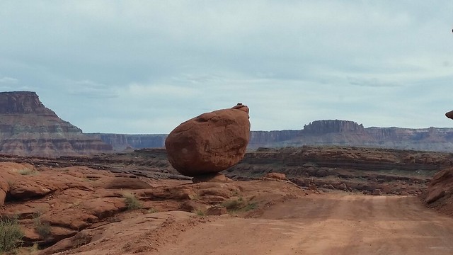
As the road continued upward it went under a small boulder over the road.
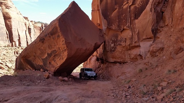
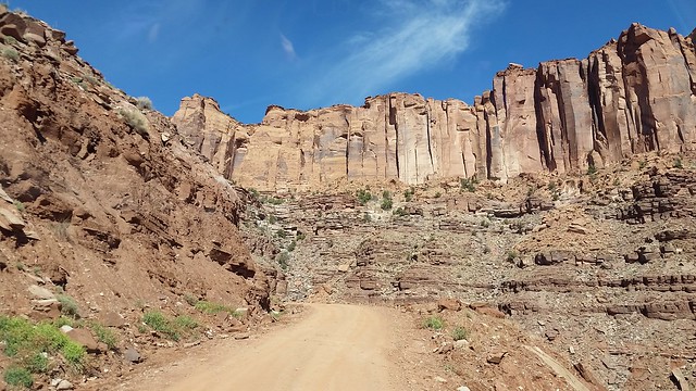
Just pass the boulder the road goes up through an area called “Pucker Pass.” We’ve been up this road before with little problem, but the road in the canyon is now in poor shape in two areas. We met a family in an all-wheel drive Subaru earlier and they followed us up the canyon. But they couldn’t get up “Pucker Pass” and were forced to back down and turn around. You definitely need four wheel drive and high clearance in this short section of the drive.
Pucker Pass
A quarter mile past the difficult section of the canyon is the top of the mesa where the road levels out.
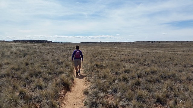
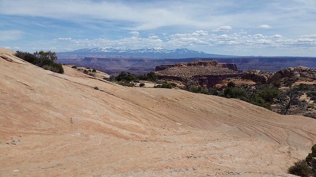
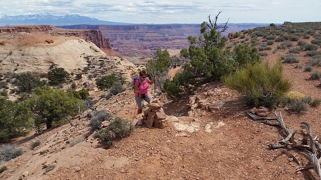
We soon entered Canyonlands NP and after a stop at the visitor center drove a couple of miles to the Lathrop Canyon trailhead. This trail goes all the way down off the mesa to the Colorado River over five miles away. The ranger said that if we hiked about two and a half miles we would be at the edge of the cliff and have a great view of the river below. That sounded like a good distance for us. For the first mile the trail goes straight across an open meadow with the La Sal Mountains in the distance.
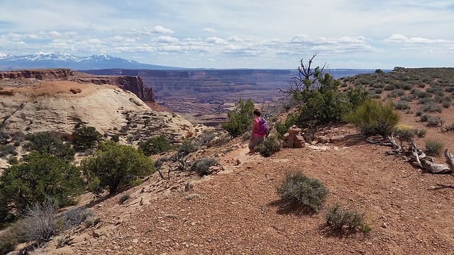
The trail then went over some slickrock before dropping down onto a very wide ledge.
Over slickrock
Dropping down
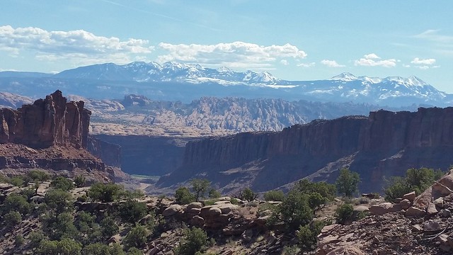
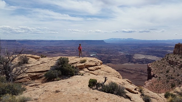
We reached the rim of the canyon overlooking the Colorado River and found the ranger to be very accurate in his description, the views were outstanding.
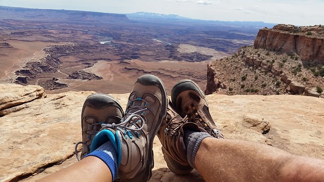
Lunch with a view
After enjoying the great vistas while having lunch, we turned and headed back.
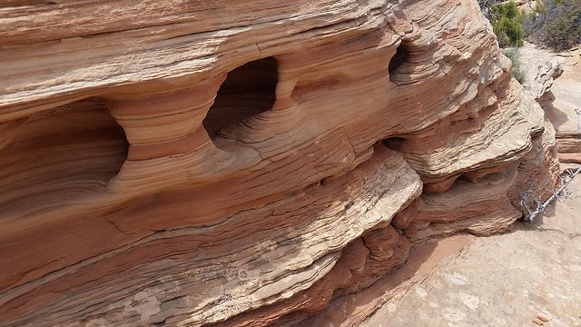
Wind and water carved the sandstone
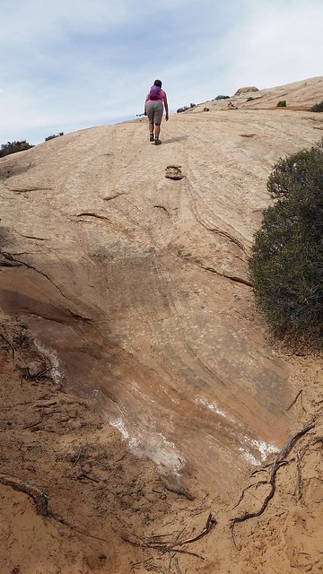
Back up the slickrock
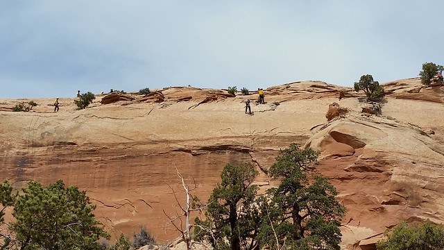
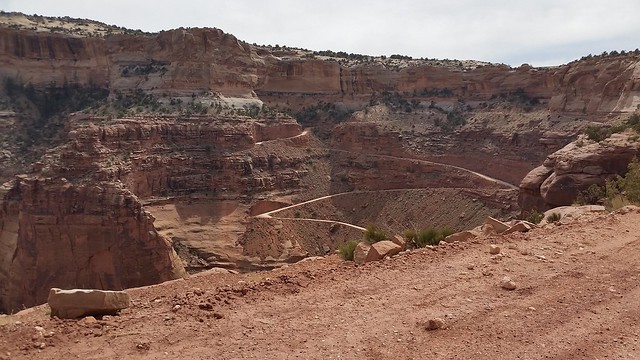
After returning to the Jeep we drove back past the visitor center and turned right on to Shafer Canyon Road. This dirt road winds steeply down from the mesa along the side of the steep rock wall. Just as we began to descend along the canyon wall we spotted a group of people rappelling down the wall. They appeared to be part of a rescue team practicing their skills.
As we continued our descent we could see where we were headed way down below us.
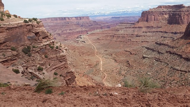
While the road is pretty smooth, this part of the drive is not for anyone with a fear of heights.
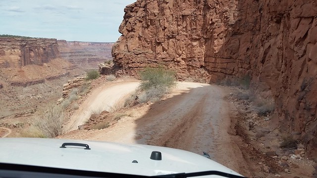
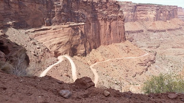
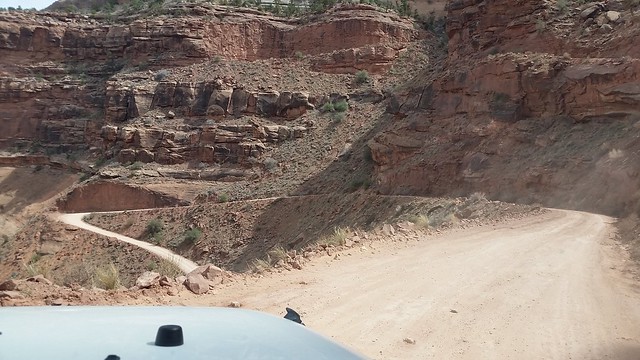
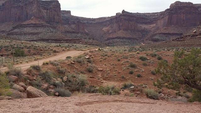
After winding steeply down for about a mile, we finally reached the bottom and the road became much flatter.
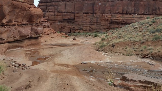
A little water as the trail goes through a wash
Soon the road winds around the Potash Extraction Facility of the Intrepid Potash Mine. The facility uses a solution system to extract potassium from a mine and solar evaporation to re-crystallize it. A solution of water and salt is pumped into the mine where it dissolves the potassium. The brine mix (potash) is then pumped into shallow evaporation ponds, where a blue dye is added to aid in absorption of sunlight.
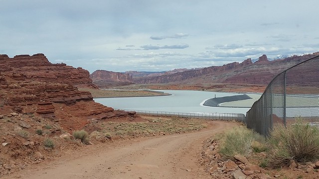
The blue water of an evaporation pond
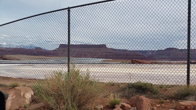
Once the water evaporates, the potassium that remains is scraped from the dry pond and sent to a facility for processing. It’s difficult to see through the fence but the pond in the photo below has dried and you can see where a scraper has removed most of the white potassium.
We continued past the evaporation ponds to the beginning of Rte. 279 and made our way along the Colorado River back to Moab.
What a great first adventure in the Moab area! We have a number of hikes and drives planned for the next few weeks during our stay here.
More on that later . . .

Although we have been to Moab a couple times, we have yet to visit Canyonlands. We tend to stay to the more “dog-friendly” trails in the area. When I was reading your section on the Shafer Trail I was waiting for a picture of one of my favorite areas where you overlook the bend of the Colorado. Love that spot!
Sorry, we didn’t get out of the car for any photos this time on the Shafer Road. We’ve done posts on this drive with tons of photos prior. Since our day included so many activities, John had to pick and chose:)
Guess we won’t make it there! But the views and your write up were excellent! Hubby isn’t fond of heights and after one daring trip on a Forest Service road in the Smokies, all dirt roads are off limits. As much as we wanted a Jeep, he knew we’d never be this adventuresome! Lol
Debbie, we took the dirt back roads but there is regular highway to Canyonlands so you can get there, too:)
Ok! But it looks more like an adventure on the back rounds. I’m just a bit envious….😄
I thought Canyonlands offered views as awesome as the Grand Canyon.
I have to agree with you, Larry!
God’s country for sure! Positively beautiful and breathtaking! I was there last summer and I eventually plan to move out that way. 🙂
You are right, Michelle:) This is our third year here and we just love it.
You are a blog writing queen! I miss you reading for a few days and you’ve already got 3 new ones up! Totally loving all your red rock madness. We spent a few weeks in Moab a few years ago, but it wasn’t nearly enough. Can’t wait to see the rest of your adventures here.
Nina
Nina, John has taken offense to your calling him the “writing queen.” Maybe “writing King” would be better. He is the author of the blog:) I do most of the photos and editing. But we got a good laugh out of your comment:)
Good thing you guys have a jeep to get to these “hard to reach” trailhead! – Alicia @ http://www.girlonahike.com
We are very glad we have a Jeep in this area of the country, Alicia:)
That boulder you drove under…. Very cool indeed!
The photos are incredible!
Be careful out there… I notice you are alone.
Thanks, Nancy:) We generally only travel off road in more popular areas. We also have our SPOT button with us if we should have a problem:)
🙂 Glad to hear!
Canyonlands and that whole area is absolutely fabulous, although we soon discovered that our truck was just too big for most of the dirt roads. Have fun!
I agree that the area is fantastic:)
Wow, those were some hairpin turns! It looked as crazy as the Moki Dugway near Valley of the Gods! Spectacular views you had for your first “lunch with a view” in the Moab area.
The area coming down off the mesa does resemble the Moki Dugway just narrower and steeper…one lane!! Glad you enjoyed our first lunch view:)
Love that area of Utah. I so wanted to drive that loop. We drove part of Long Canyon Road then turned around when it got rough. We weren’t sure where we were and didn’t want to get ourselves in over our heads. It’s prudent to be prepared in the back country as you well know.
The dirt roads certainly to change with the weather out here. Most of Long Canyon was as we remembered, but Pucker Pass had really deteriorated with a couple of ledges to climb.
We plan to visit southern Utah in May, but hubby is pretty afraid of heights. Just looking at maps we can hopefully see a lot of country without freaking him out…..what do you think? We will mostly be doing scenic drives….any advice? Feel free to email if you wish.
Oh grief! There is no way on this dear earth I would do that drive. You two make me so nervous sometimes and this is ONE! I hate those switchbacks!
On a positive note. The Vistas are gorgeous. I love the La Sal Mts. Lunch with a view is amazing! Keep enjoying the good life.
I did think of you, Marsha, and knew you wouldn’t have enjoyed the road. Luckily, there is a paved “normal” road around to the park:)
We have not done a lot of hiking in Canyonlands…plan of fixing that this year. YOUr hike is definitely on the list. Last year Long Canyon road was washed away…we didn’t know it and headed down (for some reason we always go down Long Canyon and up Shafer Canyon. What an adventure that was! See you both Friday!
Our intent was just to ride up Long Canyon and then hike in Canyonland. But we also wanted to check out Shafer Road to see if Steve and ML would be able to do it in their CRV so drove that back home. We’ve never driven down that road before. We always go up. Boy, it really was different…worth the reverse trip! See you Friday!! I understand you are just one over from us and ML is across from us. Let the Good Times Roll!!
We can hardly wait!
What an adventure. We love Canyonlands. Still want to do the Grand View Point Trail. Didn’t have time at the end of the day when we were there on my mom’s 80th birthday hiking trip in 2006.
Island in the Sky is a special place. Too bad it is so far to get there.
Wow you did some driving on rough roads today. Love going under the boulder. Laughing at “pucker pass”. But boy the views. Those La Sals look just beautiful. Wonderful day from the looks of it.
It was a wonderful, long day, and the views make the time fly by:)
Gotta give that family credit for trying to get their Subaru up Pucker Pass. Now way would I let Jim even attempt that one!
Up until Pucker Pass they were doing well, and you would have been fine, also. Too bad there were those two ledges!! They were only yards from the flat.
What a fantastic day! Thanks for the info on the potash processing…I’d wondered about it but not bothered to look it up! Having a Jeep in Moab is a wonderful thing.
It is amazing sometimes what I learn when I edit the blog:) Glad John is curious and enjoys researching. Yes, a Jeep is a good thing to have in this area:)
Sometimes it’s just one little section of a long drive that makes us so glad we have the Jeep! I’m thinking I might be able to drive down Schafer (for some reason it’s the going up that freaks me out), especially if I were following another vehicle. We’ll have to test that theory one of these days 🙂 The little boulder is awesome over the teeny Jeep. The views are amazing, and this is only the first day!! I always think about what it took to figure out the complicated and large scale processes to takes to “make” something like potassium!
We have always come up Shafer Road. I was surprised how much harder I thought it was coming down the switchbacks. Yes, we have been thankful we had the Jeep when we weren’t sure about the road.
Oh how I long to return to Canyonlands but it will now have to wait until fall. I love those steep windy roads and Bill has it down driving them. Your adventures are helping create my list of must see and do.
After our month here, Gaelyn, we should be able to give you lots of ideas:)