As we said in our previous post we had visited Farmington for a few days at the beginning of this trip. That’s because the nimble hiker wanted to visit an area south of the city called the Bisti Badlands. But the temperatures were much too high at the start of September so we decided to return here at the end of our trip since our planned route already had us in nearby Cortez, CO.
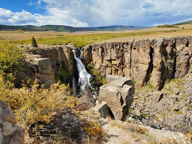
So after spending a few days in Cortez with Dave, Sue, and Lewis, we drove about 80 miles back south into New Mexico and again set up the motorhome in the McGee Park, the San Juan County Fairgrounds just east of Farmington. The next day we were up early and headed south on NM 371 (aka the Bisti Highway). After 36 miles on NM 371 we turned east on to CR 7291, a well maintained dirt road. In just under two miles we came to a “T” where we turned north on CR7290. One mile up that road and we came to the parking area for the Bisti Badlands. There were many campers staying in the parking lot but it is fairly large and we had no trouble finding a spot for the Jeep. There is a covered picnic table and a pit toilet in the lot if you need it.
The Bisti Badlands is part of the Bisti/De-Na-Zin Wilderness, a 45,000-acre wilderness area. Established in 1984, the Wilderness is a desolate area of steeply eroded badlands managed by the Bureau of Land Management, with the exception of three parcels of private Navajo land within its boundaries. Time and natural elements have created a world of strange rock formations made of sandstone, shale, mudstone, coal, and silt.
Heading toward the hills
We parked the Jeep, grabbed our packs, and headed out to the east over a wide flat area for 1.7 miles to our first area, the Egg Hatchery. There is no set trail so you just head east toward some low hills (look for other hikers in the distance). We had downloaded a map with coordinates for some of the best rock formations and used a hiking app to keep track of our route since there is no designated trail and no signs.
The Egg HatcheryHoodoo CityPetrified WoodPhotobombing pillar makes for a new look hatStone Wings
We spent two days exploring the area, hiking in the southern formations on the first day and exploring formations on the north side the second day. We think we could have spent a week there and not see all there is to see. It is a very interesting place, well worth the effort to get there.
We’re now back home in southern Nevada after a wonderful month exploring central and southern Colorado and a bit of northern New Mexico. We have no motorhome travel plans until at least the middle of January so the blog will be quiet for a while. But we will return in the future with more adventures.
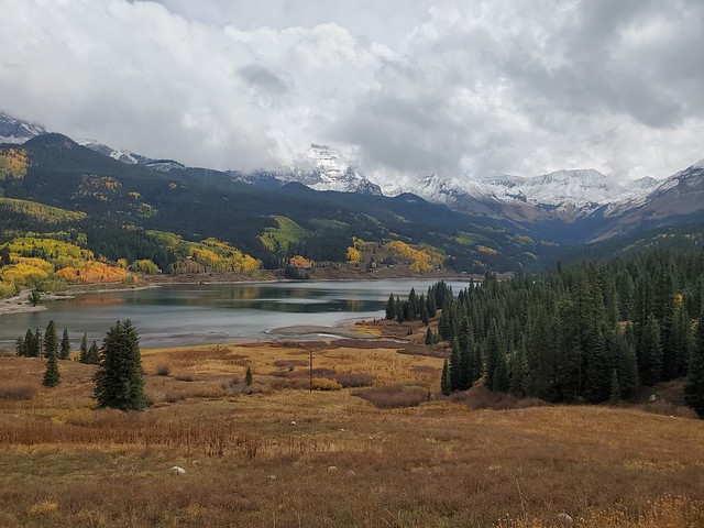
After a one night stay in Ridgeway State Park we took advantage of a nice day and headed south to Cortez to avoid the rain predicted for the next couple of days. Since we would be going up and over a couple of high mountain passes (Lizard Pass is over 10,000′) again, we decided to have Pam drive the Jeep instead of towing it with the motorhome. This also allowed her to get some great photos of the high mountains and the beautiful colors of the Aspens all around us.
Trout Lake just south of Telluride, CO
We knew our friend, Lewis, was staying with his friends Dave and Sue in nearby Dolores, so the first thing we did after setting up in Westview RV Park was to head over for a visit.
Difficult selfie attempt
The next day Dave and Sue moved their motorhome from the park in Dolores to the site next to us in Cortez. That made it much easier for us to get together and for Lewis to come over for a visit. For some reason he loves hanging around in our motorhome.
No I’m not coming home!
That night the predicted rain came, with snow at the higher elevations. We invited Dave and Sue to join us the next day for a ride back over Lizard Pass to enjoy the views of the snow covered mountains and for a visit to the beautiful little ski town of Telluride.
Trout Lake again but with snow
Telluride is surrounded by high mountain peaks that are especially beautiful when covered with a fresh snowfall.
We had lunch at Steamies Burger Bar on the right of the photoWilson Peak (14,023′) of Coors Beer can fame
We enjoyed spending a couple of days with Dave and Sue before they headed back into Arizona on their way to their new home in Wickenburg. We did a bit of exploring the area with them and went out to dinner in Cortez but forgot to get any photos.
After they left we packed up and headed about 80 miles south into New Mexico for a return visit to Farmington. We stopped there about a month ago at the beginning of this trip but it was still too hot to do a hike the nimble hiker had on her radar. Temperatures have moderated since then so we decided to circle back for a couple of days.
Toward the end of our visit to the Salida area we drove north to visit an old ghost town. But first we made a brief visit to the town of Buena Vista. North of town we crossed the Arkansas River on County Road 371 to visit a large boulder called Elephant Rock. Just before the boulder we drove through a series of tunnels that were once part of the Midland Railroad.
Just past the tunnels is Elephant Rock.
See the elephant looking at you?
Driving back down US 24 from Buena Vista we turned west on Chalk Creek Drive just south of the little crossroads community of Nathrop. After 16 miles (partly paved and partly maintained dirt) we came to what is essentially the end of the line in the restored mining community of St. Elmo. Nearly 2,000 people settled in this town when mining for gold and silver started. The mining industry started to decline in the early 1920s, and in 1922 the railroad discontinued service. Few people continued to live in the town. Postal service was discontinued in 1952 after the death of St. Elmo’s postmaster.
St. Elmo was originally named Forest City but was later changed because of the multitude of towns with the same name. The name St. Elmo was chosen by one of the town’s founding fathers who was reading a novel with the same title. The community is listed on the National Register of Historic Places as the St. Elmo Historic District. It is one of Colorado’s best preserved ghost towns.
Along the road to St. Elmo is the Mount Princeton Hot Springs Resort. The resort is built around an odorless hot spring with water reaching the surface at 140 degrees.
On our last day in Salida we decided to visit the downtown area of the city. But first we drove west on US 50 to check out Monarch Pass. We would be driving the motorhome over the pass the next day but wanted to go up and enjoy the views in the Jeep first.
The view east just below the pass
The Monarch Mountain Ski Area is located just east of the summit.
Returning back down from the summit of Monarch Pass we drove into the city of Salida. With a population of about 5,300, the town sits right along the Arkansas River and is the county seat of Chaffee County.
As we drove through some residential areas heading for the downtown we noticed a number of deer just meandering through the neighborhoods enjoying the plentiful vegetation.
Across the river from the downtown area is Tenderfoot Hill which has a large communications tower on its peak and a large “S” on its west side.
A narrow dirt road winds its way up to the top of the mound, with a great view of the city below.
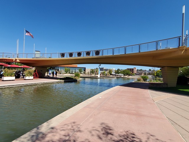
Salida takes full advantage of the Arkansas River for recreation. A nice path runs along the water on the town side of the river.
Near the center of town there is an area where you can sit and watch kayak racing during high water in the spring, or just enjoy a cold drink from that national chain coffee house located in the nearby Safeway Market.
Gates used during kayak competition.
The next morning we left the Salida KOA and headed west over Monarch Pass to the town of Gunnison. Since the drive was only about 60 miles and with the climb over the pass, we didn’t hook up the Jeep.
Heading up to the passThe motorhome crosses the summit at 11,312′
Our original plan was to drive from Salida to Montrose. But in researching road conditions in Colorado we discovered that there was a major construction project on US 50 between Gunnison and Montrose. During the week the road is closed for most of the day, with a limited number of vehicles guided through the construction three times a day. If you don’t get into a group, you have to sit for hours until the next crossing. But there is no construction on weekends and the road is full opened from Friday evening until early Monday morning. So we stopped in Gunnison and waited a day before continuing across through the construction during the weekend.
Construction area on US 50
The drive across US 50 was easy, except for two areas where they are cleaning up a rock slide and widening the road. A look at the photos confirms why they close the highway during construction as there is no way they could maneuver heavy equipment in those narrow areas with traffic behind them.
Another view of US 50 construction
After crossing US 50 we turned south on US 551 and drove about 15 miles to Ridgeway State Park where we had a reservation for three nights. We stayed there two years ago and did a lot of exploring, but wanted to return to drive some Jeep roads we missed on that visit. However, the weather report was for one nice day followed by a couple of days of rain. Since exploring dirt Jeep roads in the rain isn’t very much fun we changed our plans, cancelled the second two nights in Ridgeway, and continued our journey south to Cortez, CO.
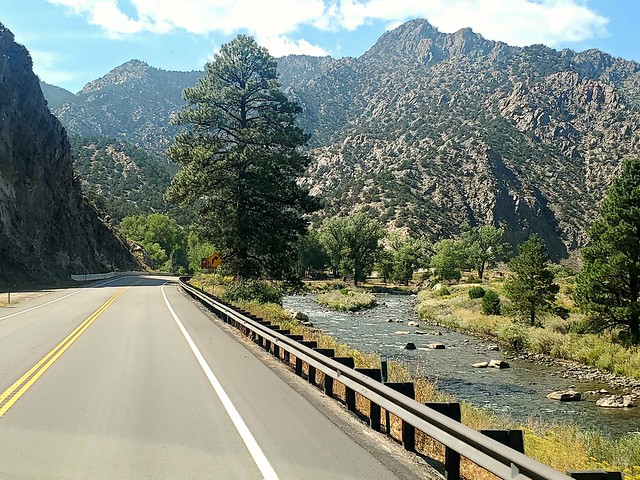
Leaving Pueblo we headed west on US 50, enjoying the views all around us as the highway meandered along the Arkansas River.
As we approached the town of Salida some of Colorado’s many 14ers came into view. Colorado has 58 mountain peaks exceeding 14,000 feet (known as 14ers locally), the most of any state. Chaffee County, home to Salida, has twelve peaks which rise above 14,000 feet, making the county the one with the greatest number of 14ers in the state.
We continued past Salida for about 10 miles to the Salida KOA, our home during our visit to this area. The KOA is a decent park with great views all around us. Looking out the windshield of the motorhome we had a beautiful view of mountain peaks in the southern Sawatch Mountain Range. We’ll be crossing that range over Monarch Pass in a few days.
Our first adventure in this area was a drive about 60 miles north on US 285 and US 24 to the town of Leadville. This route is known as the Collegiate Peaks Scenic Byway. The byway runs through the Collegiate Peaks wilderness area, named so because of the many nearby 14ers with names of prestigious universities: Mt. Oxford, Mt. Harvard, Mt. Yale, Mt. Princeton, and Mt. Columbia.
At an elevation of 10,152 feet, Leadville has the highest elevation of any city in the United States.
A former silver mining town that lies at the headwaters of the Arkansas River, the Leadville Historic District contains many historic structures and sites from its mining era. In the late 19th century Leadville was the second most populous city in Colorado after Denver.
As we drove around the residential areas of Leadville we were so impressed with the stunning views all around us.
Leaving Leadville we returned south along US 24, stopping to enjoy the view at Twin Lakes, two beautiful reservoirs along Lake Creek.
We then continued south on US 24 to the small community of Granite. There we turned west on County Road 398 (Lost Canyon Road), a maintained dirt road that goes across a flat plain before heading steeply up into the mountains.
The changing leaves of the Aspen trees lit up the road as it went through a series of switchbacks while gaining elevation.
The brown area in the center is our destination.
As we approached the tree line the maintained road ended. We put the Jeep in four-wheel drive and continued up the narrowing path to see what we could find.
Soon our efforts were rewarded as we came to a stunning view of the Twin Lakes far below us.
Remains of an old cabinWindow view of the mountainsNo trees up here!View southView northPassing a biker on the way down (good lungs at 12,000′)
We have a couple more adventures to share from our visit to Salida. We’ll show you those in our next post.
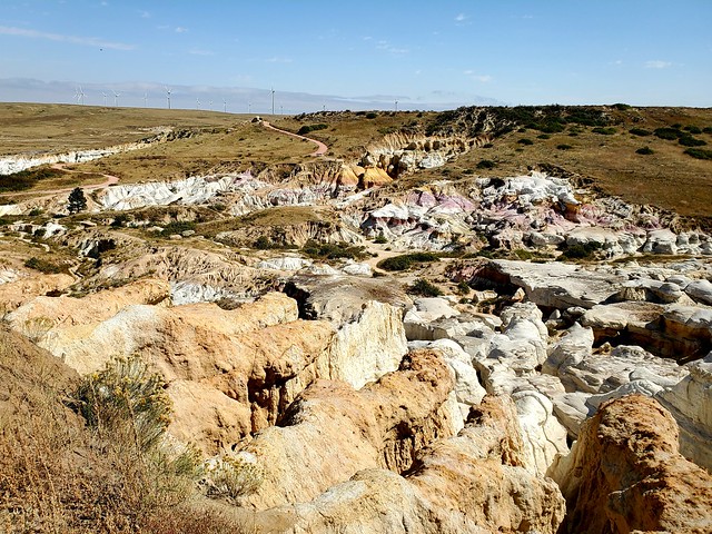
One of the places we were looking forward to visiting during our time in this area is the Painted Mines Interpretive Park. Located about 30 miles east of Colorado Spring the park consists of 4 miles of trails that rise over 500 feet in elevation. It covers 750 acres, containing grassland and geological formations of hoodoos, colored clay, and sandstone-capped spires. Approaching the park, one might start to wonder if they are in the right place as there is nothing but flat grasslands for as far as the eye can see. But soon the ground opens up to a small ravine that has eroded away over time, revealing richly colored clayish rocks, in shades of yellow, purple, red, and gray.
There are two parking areas next to the park. One is near a viewpoint where you are standing above the formations looking down at them.
The second parking area gives you access to a trail that leads down into the formations.
Once at the bottom of the trail, visitors are free to just wander through the formations. From this point in this post we’ll let the photos tell the story of our visit to the Painted Mines.
On our final day in the Pueblo area we went downtown to walk the Historic Arkansas Riverwalk. This one mile long canal through the center of the downtown is a tourist attraction inspired by the San Antonio Riverwalk.
The water follows the former route of the Arkansas River. At one time the river ran right through the center of town before a devastating flood in 1921 destroyed the downtown and changed the course of the river south of the city.
That’s it for our visit to Pueblo and Colorado Springs. Next up is a stay in Salida, CO. More on that in our next post . . .
Leaving South Fork we headed east on US 160 for about 120 miles to Salsenburg, CO where we turned north on I-25. After about 60 miles we arrived at the Pueblo KOA, our base for some visits to nearby Colorado Springs. We looked at staying closer to Colorado Springs but had trouble finding a park.
Our first adventure was a ride up the cog railroad to the top of Pikes Peak. We rode the train a few years ago (OK, it was 30 years ago!) but don’t remember a great deal from that experience. Plus the railroad just recently re-opened after being closed since 2017 while undergoing a complete renovation.
Pikes Peak from I-25 (the barren peak through all the power lines)
The rail line starts at a depot in the town of Manitou Springs, located at an elevation of 6,320 feet, and climbs 8.9 miles to the summit of Pikes Peak at an elevation of 14,115 feet. The average grade of the line is 12% but tops out at 25%. Normal trains can not retain traction on the rails at grades steeper than 10%, so the railway needs to use a cog and rack system to help pull trains up the mountain and control the speed of the descent.
Going up
The trip one way takes about an hour and ten minutes. There is a forty minute stop at the summit to enjoy the views and check out the new visitor center. That totals up to a three hour experience.
Colorado Springs below as we clear the tree lineLake MoraineWindy Point – old steam engines replenished their boilers hereAnother view of Lake Moraine
Below is a view of Manitou Springs from the summit. In the center of the photo you can make out three rock formations. That is an area known as Garden of the Gods. We’ll share our visit there later in this post.
The Pikes Peak Summit House is a National Historic Landmark and the continued production site of what have become, over the last century, cult favorite donuts. Pikes Peak Summit House donuts can only really be consumed at the summit of Pikes Peak. The recipe is optimized for the high altitude; thinner air means lower air pressure, which means a lower boiling point for water (186 degrees rather that 212 degrees). Try taking the donuts to a lower elevation and they’ll collapse, their fluffiness will disappear. The Summit House was completely rebuilt during the recent cog railroad renovations, including an eco-friendly new donut making machine. The new machine is so large (about 1,500 pounds, 92 inches tall and 84 inches wide) that crews had to bring it in early, then finish the building around it.
We planned to bring a portion of the donuts back with us to see it collapse, but that didn’t work out so well. The photo below tells the story of what happened to that specimen.
Two trains sit at the summit in the photo below. The one on the right is about to return back down the mountain. We came up on the one on the left, and will re-board it in a few minutes.
The train we rode during our first trip up Pikes Peak
Below is a photo of the sign that once sat at the road that leads to the summit. A few years ago the elevation of the peak was recalculated and the peak is now listed at 14,115 feet so the sign has also undergone a renovation.
Don’t miss the train, it is the final one of the day!Going down
While we enjoyed the experience, we don’t think we would take the cog rail up to the peak again. Our main concern is the crowding in the cars. Previously the configuration was two seats on either side with the seats facing two seats across from you. The new cars have three seats on one side and two on the other. The cars were manufactured in Switzerland and we don’t think the Swiss are as “supersized” as many Americans. And with limited room between the seats facing each other, you play knee-tag with the person across from you for two hours and twenty minutes. And while the views as you approach the summit are impressive, for most of the ride you are going through a pine forest with limited visibility. Even with these concerns, if you have never done it, we would still recommend a trip on the cog railroad (one time).
The next day we returned to Colorado Springs to visit an area of rock formations called the Garden of the Gods. We took a tour of the area shown below called the Perkins Central Walking Tour. Remember the photo earlier in this post showing the Garden of the Gods from Pikes Peak? Below is a reverse view of that photo.
A wide, concrete walkway weaves its way between the formations.
See the climber?
In 1879 Charles Elliott Perkins purchased 480 acres of land that included a portion of the present Garden of the Gods. Upon Perkins’ death, his family gave the land to the City of Colorado Springs in 1909, with the provision that it would be a free public park. A plaque on one of the formations commemorates this gift.
We spent the rest of our visit roaming among the formations.
Pikes Peak
All our photos make it appear that we were alone in our exploration. But the area is one of the most popular tourist spots in eastern Colorado and is always filled with visitors. The nimble hiker is also very nimble with a camera and was able to capture the rock formations while avoiding the inclusion of the masses. Even with the many people sharing the walking paths, we enjoyed observing the many beautiful formations.
We have one more adventure in this area before we head west. We’ll share that in our next post.
The Underground Mine Museum is located north of the town across from the skating ponds and next to the fire station garage. The combined gift shop, community center, and museum are all completely underground.
The museum entrance
Construction of the museum was begun in 1990 and completed two years later. Construction was completed by a group of former miners who wanted to replicate the mines in which they worked. The tour through the “mine” is self-paced with each person listening to information on headphones with an Ipod like device. The temperature inside the museum is a constant fifty degrees. The museum has a rack of used coats available for those who don’t come prepared for the cold.
Main hallway through the museum
The story of mining is told through a series of dioramas depicting a different part of the mining process, moving from early days through more modern times. The photo below is the first display and shows the physicality involved in early mining. The miner is standing on a platform with a long iron drill bit in one hand and a sledge hammer in the other. He would strike the drill four times with the sledge, swinging it underhanded, then turn the bit one quarter turn. He would then repeat the process three more times to complete one turn of the drill. Each turn of the drill drove the hole an eighth of an inch deeper. The process would be repeated until the whole was twelve inches deep. The miner would drill eight to ten holes a day! Bet he didn’t go to the local LA Fitness after work!
The drill used in the photo below was an improvement to the hand drill. It was often used to drill a hole vertically over the miner’s head. The dust created would drop down over the minor, often so thick he couldn’t see his hand in front of his face. Wonder why it was called the “Widow Maker.”
Typical side tunnelA vertical shaft. The miner stood on the platform to drill above him
Below is a wide area of the mine with a table that served as a lunch area. Next to it is a small rail car with a round, yellow seat on top. The Honey Wagon! It is reported that the bosses often parked the Honey Wagon near the lunch area. They didn’t want the miners to get too comfortable and delay their return to work.
The tour continues beyond those displays, showing the progression of mining improvements. But despite the improvement in safety and equipment it is still a very, very difficult way to make a living!
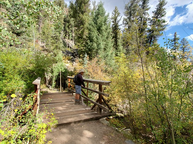
The next day, our final in South Fork, we went back up to Wolf Pass for a short hike. We drove west on US 160 to a well marked parking area for the Lake Fork Trail. The trail crosses a small stream, then goes up a canyon following the stream.
The trail through a rock slide
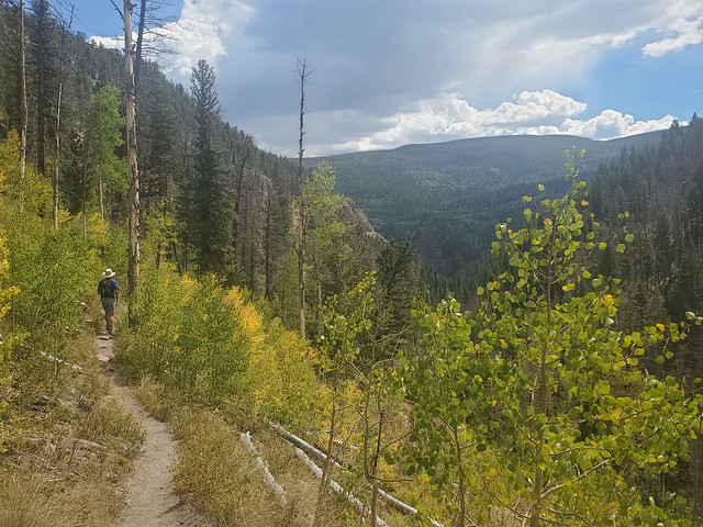
We hiked up the canyon for a couple of miles to enjoy the view before returning back down to the Jeep.
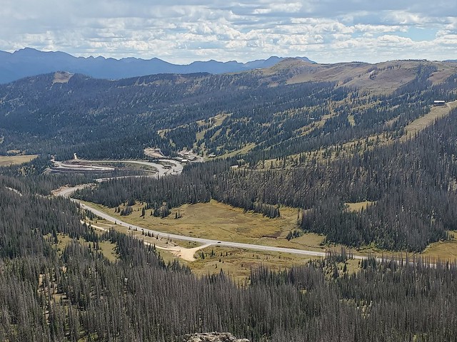
Returning back to the Jeep we continued west on US 160 heading up to Wolf Summit. On the way we passed the Wolf Creek Ski Area.
Just a short drive up the highway from the ski slope is the Wolf Creek Pass summit where there is a wide parking area and display panels.
Across from the summit parking area is a dirt road that leads up to the top of the peak. There is an observation area there called Lobo Overlook with a great 360 view.
The ski area from Lobo Overlook
That’s a wrap for our brief visit to the South Fork area. We love the area and there is enough to do and see that we may return for another visit in the future. But it is time to move on to our next stop in Pueblo, CO.
About 20 miles north of our base in South Fork is the community of Creede. The little town, sitting at an elevation of 8,800′, has a population of 220 permanent residents. But during the summer that number grows due to summer residents and the many tourists who visit the area.
Like so many towns in the west, Creede was founded as a mining town. Creede was the last silver boom town in Colorado in the 19th century. It grew from a population of 600 in 1889 to more than 10,000 people in December 1891. The Creede mines operated continuously from 1890 until 1985, and were served by the Denver & Rio Grande Railroad.
Early in its existence Creede was a rough and tumble gambling town. While Creede was booming, the capital city of Denver was experiencing a reform movement against gambling clubs and saloons. Many owners of gambling houses in Denver relocated to Creede’s business district. One of these was Robert Ford, the man who killed outlaw Jesse James. On June 5, 1892 a fire destroyed most of Creede’s business district. Three days later, on June 8, Ed O’Kelley walked into Robert Ford’s makeshift tent-saloon and shot him dead.
While the gambling era brought some people to the town, the real money was in mining. Mines north of town produced large amounts of silver, gold, zinc, lead, and copper. Our main objective for our visit was to drive the Bachelor Loop Historic Tour, a 17 mile drive through the historic mining district in the steep hills above the town. It is a local recommendation that two wheel drive vehicles do the loop in a clockwise direction, while four wheel drive vehicles can go counterclockwise. That is because the road just north of town goes up steeply in an area called the Black Pitch. A clockwise direction has you coming down the pitch, rather than up. We did the counterclockwise route but didn’t find the road that difficult.
In the town photo above you can see a canyon in the background. That is the road leading up to the loop. As we drove out of the town to begin the loop we noticed a large opening in the rock face on our left. Turns out it is home to the town fire truck. Just next to it, also cut into the rock, is the town community center and the Underground Mine Museum. We’ll tell you more about this museum in our next post.
Creede Fire Department
Across from the fire department and community center we came upon two ponds surrounded by gravel.
We didn’t know what the ponds were used for until we saw the sign on a small building next to them.
We then noticed the lights surrounding the ponds and a couple of hockey sticks floating in the shallow water. We stopped (for a second time) at the visitor center in town after driving the loop and were told the two ponds are quite busy during the winter. They even have a Zamboni (ice surfacing machine) in a small garage next to the skate shack. Forgot your skates? The skate shack is like an unattended lending library. Just borrow a pair of skates and return them when you are done.
The start of the loop road
The first mine we came to was the Commodore Mine. The mine had buildings on five levels above the road and was called one of the greatest silver mines on earth, with production taking place between 1891 and 1976.
five levels of the Commodore MineThe mine in 1904
Across from the mine is the remains of the Commodore Ore House and Chutes. Here ore from the mine was loaded into wagons for a trip down to the beginning of the rail line.
Continuing up the roadAnother old mineThe road levels off at the top of the canyonThe Aspens are beginning to changeLooking down at Chreede as we begin to descend
After finishing the Bachelor Loop we returned to the beginning of the canyon to visit the Underground Mine Museum. We’ll tell you about that in our next post.
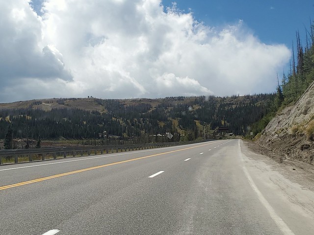
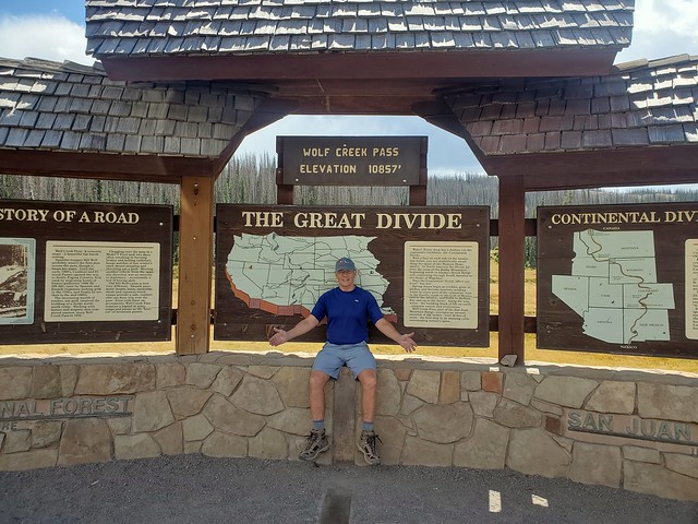
The drive from Farmington, NM to South Fork, CO is about 345 miles. Most of the trip is through fairly flat, scenic country. But just beyond Pagosa Springs there is one final obstacle, the Rocky Mountains. Apparently nobody bothered to build a tunnel through these obstacles so the only way to get to the other side is to go over them! We were traveling on US 160, one of only three main east to west routes through Colorado (the other two are I-70 and US 50). All three are good roads with passing lanes where needed.
US 160 goes over Wolf Pass, with an elevation of 10,857 feet at the summit. We could have left the Jeep hooked to the motorhome if we wanted (we did that on a previous trip over this pass) but since we would be un-hooking when we arrived at South Fork on the other side of the pass anyway, we decided to take the Jeep off before going up. Why haul a 4000 pound anchor up the pass if not necessary. We know the motorhome appreciated the lighter load.
Going UpGoing Down
South Fork sits at the eastern base of the mountains. We turned north on CO 149 at the only main intersection in the area and drove a mile or so to Aspen Ridge RV Park, which will be our home for the next few days.
Aspen Ridge RV Park
The community of South Fork sits along the confluence of the South Fork River and Rio Grande River at an elevation of 8,209 feet. It was first settled in 1882 and in 1992 South Fork achieved independent statutory town status, making it the youngest statutory town in the state. Originally the principal economic activities involved forestry and mining, but in recent years these have been overtaken in the employment statistics by tourism. South Fork has about 400 permanent residents, but a substantially larger summer population due to seasonal residents and visitors.
Two of those permanent residents are our friends, Rick and Joanne, who we have met at various locations during our travels. They now live in South Fork full time. We met at a local Mexican restaurant and enjoyed a long visit catching up on recent experiences over a delicious meal. It was like having our own travel guide for the area, as they gave us information on things to do and see nearby. But, alas, nobody remembered to get a photo so you’ll just have to trust us. We all looked as young and buff as ever!
Our first adventure here was a drive up Rte. 149 to Lake City, a drive known as the Silver Thread Scenic and Historic Byway. The 72 mile drive goes through the old mining town of Creede (we’ll tell you about Creede in the next post), up over the continental divide, to the little community of Lake City. Along the way the scenery is impressive, with beautiful vistas at the high points and the beginning of the changing leaf colors along the way.
Rain in our future
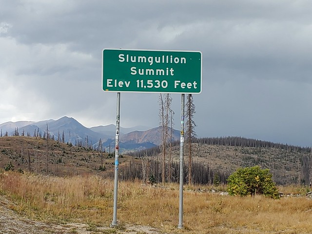
Slumgullion Summit is named for the nearby Slumgullion Earthflow, a gigantic landslide whose yellowish soil reminded early settlers and miners of slumgullion stew. The slide began about 700 years ago when weak volcanic soil on the southern flank of Mesa Seco slid several miles down the steep mountainside. About 300 years ago, a second earthflow started from the top of the mountain and is still active, moving as much as twenty feet per year. Trees growing on the newer slide are tipped at odd angles.
The first flow was so large and cataclysmic that it blocked the Lake Fork of the Gunnison River and created Lake San Cristobal, Colorado’s second largest natural lake.
Lake San CristobalWater level view of Lake San Cristobal
Lake City, named for nearby Lake San Cristobal, sits at 8,600′ and has a population of around 400 permanent residents. As with most western towns it was founded as a mining community in the 1870s with up to 5,000 inhabitants. But as often happened, the mining boom ended at the turn of the century and the population rapidly decreased. Beginning in 1915, visitors began coming to Lake City for the entire summer season and by the 1930s tourism had emerged as a viable industry.
The Lake City Historic District contains a collection of intact buildings associated with the mining era. The town’s remote location and decades of economic decline helped conserve the buildings, and the weak local economy discouraged new construction, so Lake City avoided many of the modern “improvements” to historic buildings that often occurs in more prosperous towns. Many of these restored buildings can be seen throughout the town.
School bus fleet in a small town
The local coffee shop was closed for the day as were most of the businesses so we began the return trip to South Fork while continuing to enjoy the great vistas.
Along the drive we stopped at the North Creek Falls Observation Site. It is an interesting place where you are driving on a wide, flat valley to a paved parking area. Walk a few feet down a path and a waterfall appears in front of you!
The drive up the Silver Thread was a beautiful trip through a bit of rain but mostly sunshine. Next up is a visit to Creede, CO.
After a brief hiatus (ok, it has been over a year) we’re back on the road for a few weeks. Our last post was about a brief trip to Bryce Canyon last year. Since then we have limited our travels (hasn’t everyone?) to a couple of short trips that we didn’t deem “blog worthy.” But now it’s time to stretch our legs a bit and return to the road with another trip to Colorado to explore some new places and return to some places we explored during our last trip.
Goodbye Lake Mead (for now)The Colorado River from US 93 in Arizona
We headed out the day after Labor Day, driving south on US-93 to Kingman, AZ then east on I-40. After about 300 miles we stopped for the night at Homolovi State Park, just east of Winslow, AZ.
The next morning we were back on the road and drove about 240 miles to Farmington, NM where we settled in to McGee Park, the local fairgrounds. We stayed here a few years ago and knew that, while it is nothing fancy, they have a huge number of sites with 50 amp electric and water. The fairgrounds is a good spot to stay while exploring the area.
Our original reason for visiting Farmington was to hike trails in the Bisti Badlands, south of Farmington in Navajo lands. But it is still very hot in this area so we decided to return here at the end of our trip to do the hike. But there are a few other things we wanted to see in this part of the world so we decided to stay for our planned three nights.
The first day of our visit we drove a few miles east of the fairgrounds for a visit to the Salmon Ruins. Salmon Ruins is an ancient Chacoan and Pueblo site that was constructed by migrants from Chaco Canyon (south of Farmington) around 1090, with 275 to 300 original rooms spread across three stories, an elevated tower kiva in its central portion, and a great kiva in its plaza.
The site takes its name from the Salmon (pronounced sal-mon, unlike the fish) family who homesteaded the land in the late 1800’s. The ruins of Salmon Pueblo were excavated between 1970 and 1979 by a team from Eastern New Mexico University in partnership with the San Juan County Museum Association. The San Juan Valley Archaeological Program resulted in the excavation of slightly more than one-third of Salmon’s ground floor rooms. More than 1.5 million artifacts and samples were recovered from Salmon.
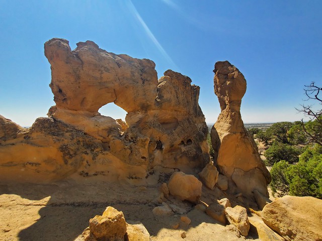
The next day we drove north about ten miles to the town of Aztec to explore a maze of dirt roads used by companies maintaining a series of gas and oil wells. There are a reported 300 arches in the area and a brochure we obtained at the local visitor center gave directions to 12 of them. We were able to find two!
Outcrop ArchPillar ArchPillar Arch from the other side
For our final adventure during this visit to the Farmington area we drove about 17 miles east on US 64 to the little community of Blanco, NM to visit Crow Canyon Archeology District, site of an extensive collection of Navajo and Ancient Pueblo rock art. Just east of Blanco we turned south on county road 4450, a dirt track well maintained by the company that operates numerous oil and natural gas wells in the area. Our information said that we should drive 19 miles, then turn left on a side road heading east toward the canyon. The problem we encountered was that there are numerous side roads there that lead to the various gas and oil wells. We explored many of these near the 19 mile marker to no avail. Continuing south we just couldn’t find any indication of the Crow Canyon site. At one point we were able to receive a weak data signal on our phone and consulted our friends at Google Maps. We quickly located the proper turn, which is at the 18.4 mile, and made our way across a wide dry wash.
After crossing the wash we came to a “T” in the road that, miraculously, had a sign directing us to Crow Canyon, about a mile or two to the north. We arrived at the site and quickly found a parking place (we were the only visitors, so it was a fairly easy task). A short trail leads from the parking area to the panels of artworkl
The Crow Canyon Archaeological District, known to be the ancestral homeland of the Navajo people, contains the most extensive collection of Navajo and Ancient Pueblo petroglyphs or rock art in the country. Etched into rock panels on the walls of the canyon are petroglyphs or rock art depicting what is believed to be ceremonial scenes and symbolic images that represent the stories, traditions, and beliefs of the Navajo people.
As you can see, most of the panels are in excellent condition. The site is very isolated and difficult to locate (as we found out) so there are few visitors. So you have to think that anyone making the journey to the site is not interested in vandalism. There are a couple of “newer” etchings made by sheep herders working the area a century ago, but they don’t significantly impact the rest of the artwork.
l
That concludes this visit to Farmington. We think we’ll return in about three weeks as we finish a loop through Colorado with a stay in nearby Cortez. Next up is a visit to South Forks, CO.