
Florence, OR
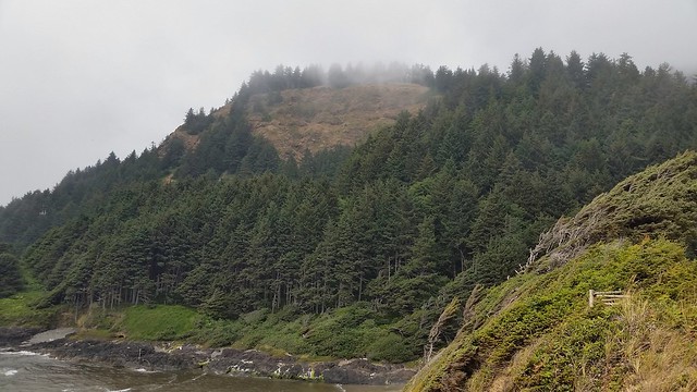
Earlier this week we drove 23 miles north on US 101 for a visit to Cape Perpetua, a perfect example of a coastal headland. A headland is land surrounded by water on three sides characterized by high, breaking waves, rocky shores, intense erosion, and steep sea cliffs. Cape Perpetua was named by Captain James Cook in 1778 as he searched for the Pacific entrance to a Northwest Passage. Cook gave the cape the name Perpetua because it was discovered on St. Perpetua’s Day.
In 1933, a Civilian Conservation Corps (CCC) camp was built at the foot of the cape just north of Cape Creek. The CCC constructed the Cape Perpetua campground and a network of hiking trails. In the 1960s the Forest Service created the Cape Perpetua Scenic Area and built the Cape Perpetua Visitor Center near the remains of the CCC camp.
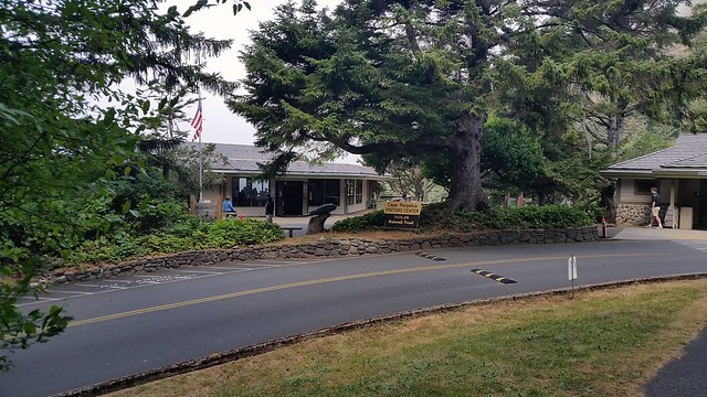
Cape Perpetua Visitor Center
After speaking with a ranger in the visitor center, we decided to take the St. Perpetua Trail, a 1.4 mile path that goes steeply up 700 feet to what the park describes as the “best view on the Oregon coast.”

St. Perpetua trailhead
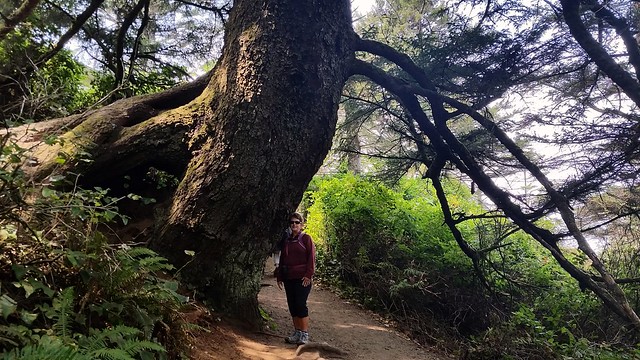
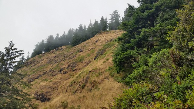
Some old growth trees line the trail
As we gained elevation the trail went right along the edge of the cliff, giving us some great views of the ocean below and the end of the trail high above us.
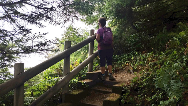
Not there yet!
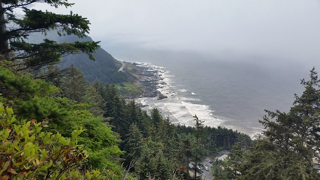
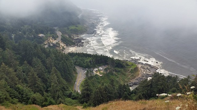
As we reached the top the fog thickened, giving the view an eerie glow.
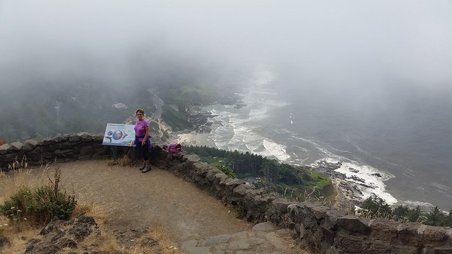
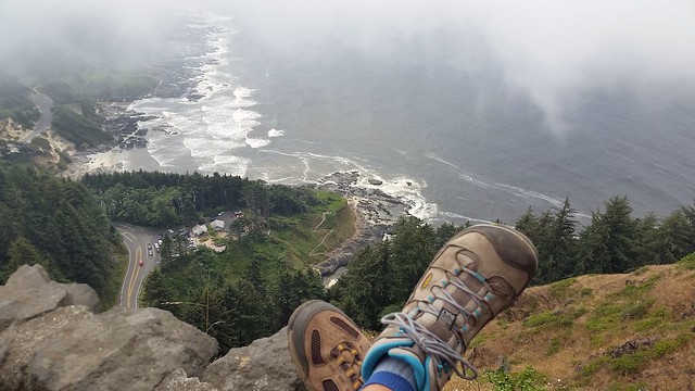
Lunch with a view

Gravity was our friend on the return hike
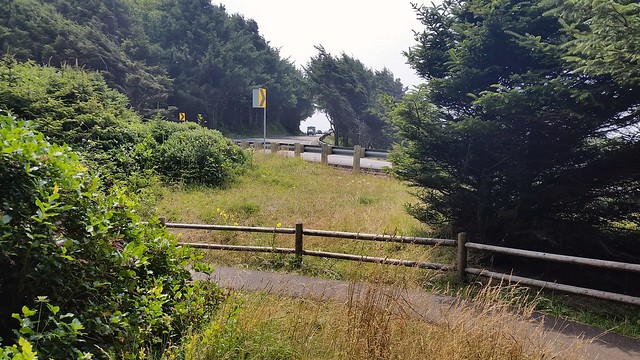
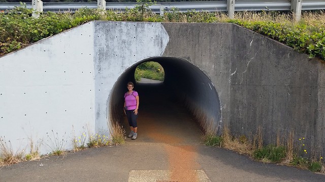
Returning to the visitor center we crossed over to a trail that leads down to the ocean. The path goes near the highway before it turns a bit and heads down to a tunnel.
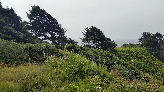
Exiting the west side of the tunnel we passed a group of trees that give a graphic indication as to where the wind comes from.
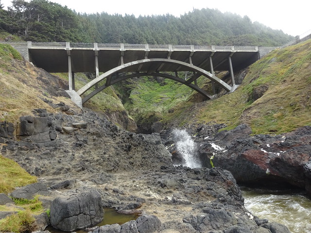
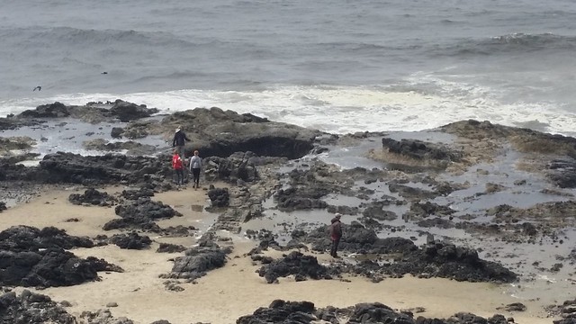
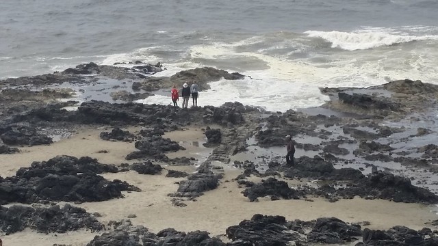
We hiked a short distance south to where a creek enters the ocean. From there we had a nice view of the bridge carrying US 101 over the creek.
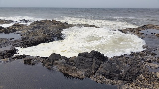
There are three interesting spots along this area of the shoreline. The first is called Cook’s Chasm, a narrow split in the rocks where water shoots up from waves during high tide.
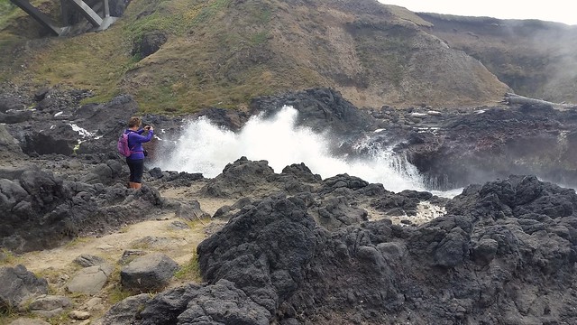
Next to Cook’s Chasm is an opening in the rocks that is known as the Spouting Horn which send puffs of mist into the air.
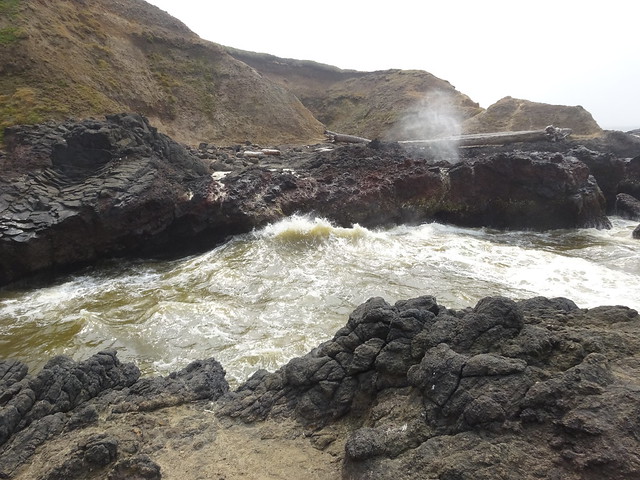
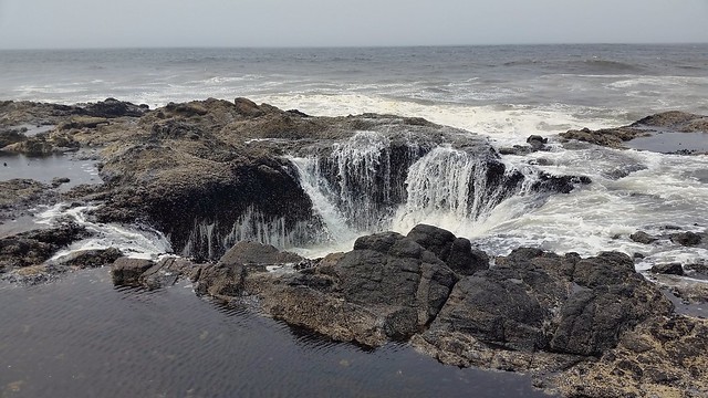
Nearby is a hole in the rock known as Thor’s Well. The hole is carved out of the basalt shoreline. One theory is that it was initially a sea cave until the roof collapsed, leaving a hole on the surface level. Because of its location right against the ocean you get a constant flow of waves rolling in from underneath and filling the bowl from the bottom. Depending on the tide level, sometimes it just bubbles to the top, while other times it’s bursting out in a violent spray.
Empty
Full
Up close full . . .
. . . draining . . .
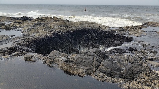
. . . and up close empty
While hiking back we could see the observation point where we had lunch, although it was a bit obscured with fog.
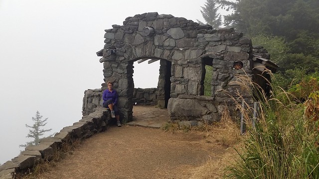
The CCC built a structure called the West Shelter observation point near the top of the cape. During World War II the shelter observation point was used as a coastal watch station and a large coastal defense gun was temporarily installed. The shelter is located up near the observation point where we enjoyed lunch earlier in the day, but we forgot about it when we were there. So before leaving the area we drove back up in the Jeep to check it out. Unfortunately, the view was totally obscured by the fog.
The Pacific is on the left, obscured by fog
While we would have preferred a clear day for our visit to Cape Perpetua, the fog did create some interesting views. If you go there, try to make it at peak high tide like we did. That’s when the Cook’s Chasm, Spouting Horn, and Thor’s Well are most spectacular.

Cape P is one of our favorites! It’s also he reason I switched to high top hiking boots, as I just about took my ankle out on the rocks down by the ocean. 🙂
We both wear high top hiking boots just for that reason, Jim. There are just too many rocks and roots on the trails.
Wow! What amazing views and phenomena. I can’t imagine the absolute beauty had it been a clear day, but the foggy effects were interesting! What we’re the temperatures? It looked a bit cool. 😎
It was a cool day with temperatures in the mid 60’s. But right along the water the temp drops even lower especially with the wind.
We never thought we’d begin preferring cooler weather-especially when hiking! Wondered how it was with so many clouds!
Isn’t that coast line just amazing. So very different from the east.
Oh how you bring back so many great memories. We didn’t do that trail, but the Captain Cook Trail. How cool are Cook’s Chasm, Spouting Horn, Thor’s Well, and the sea life along the beach. What an adventure.
Glad we could take you back to a place with fond memories!
I loved that your view was complimented by the fog. It is so “Oregon” to see it that way! Your shots of empty, and full were really interesting and really showed what the dramatic tide swings produce.
Thanks so much, Sue! It was great fun to watch the effect the high tide had on each feature.
Great pictures of Thor’s Well! We did not take the time to see it cycle thru it’s various stages. You guys definitely do it right!
Thanks, Jeff! With the high tide Thor’s Well filled and emptied very rapidly so there wasn’t much delay. Peak high tide is definitely necessary for the best viewing.
Great photos! I love that coastal view–it is interesting you guys have also had smoke, I would have thought the coastal breezes might keep you clear.
Thanks, Janna! Our winds have been from the north/northwest this week so they have carried the smoke down this far.
You are correct Pam, I would love Cape Petrpetua! Some day…
Good luck on the upcoming RV repairs and hopefully you won’t have to suffer too many days in the heat! (At least it’s cooling down inland.) I’m really glad we got to meet up while you were on the coast!
Thanks, Lisa! Sure hope the repairs are completed in a day and half at the most. Yes, it looks like it is much cooler inland. Thank goodness! It was great to get in a hike again. It has been too long! See you again soon!
Thor’s Well looks like it could be dangerous but great to watch. I love the fog except when it blocks the view. I will have to remember that for next summer.
Thor’s Well could be very dangerous. I was surprised we were able to get up right next to it. There was a Forest Ranger up on the landing and he didn’t stop any of us. Yes, you must stop if in the area, but make sure it is peak high tide!
Love the photos. I have been traveling north on the coast from CA. Entered OR yesterday and decided to stop in Florence for a couple days to explore the area. Will definitely check out Cape Perpetua! Hoping for some sunshine 😀
Thanks, Debra! Looks like a few sunny days ahead so you should have a great visit!
We loved Cape Perpetua although we missed high tide so the spout was quiet. Thor’s Well is wonderful! So appreciate that you cover the steeps and edges so I can see all those “up there” views. The lunch view makes my body parts pucker!! That old shelter is very cool. I was so happy we had some rain and low clouds today!!
It was your post, Jodee, on Thor’s Well that had me adding this stop to our list. So glad you found this great place!
The best campground also…but don’t tell anyone……
We saw the hosts for the campground but we didn’t drive in. Looks like a nice area, though.
Love your first hike up past the old growth trees to the view. Thanks for the full/empty series. Really shows it off. Definitely a place to add to our Oregon list and the campground too. Actually the heads and the coastal wells, chasms and spouts remind me a lot of Acadia with its heads and Thunder hole. Looks like a fun day. I really liked the fog pictures and the CCC lookout. For a minute there I thought you were going to say you hiked back up to see it which would not have surprised me.
The hiking trails we have done in many areas in the PNW have reminded me of what I have seen in your blogs…lots of roots, rocks, and steps. I did mention to John how Thor’s Well and Cook’s Chasm reminded me of Thunder Hole in Maine!! We do some crazy things but not hiking back up something that steep when there is a road for the second visit:)
Wow, that view from the St. Perpetua trail is amazing! But it looked like you were much too close to the edge in your “lunch” shot. 🙂 Such a great idea to do a series of photos on Thor’s Well. We haven’t been there in years, and are due for a return trip. Glad you’re staying cool.
Haha! We only put one foot on the stone wall since that was the only safe way to get the shot below. Glad you enjoy our Thor’s Well sequence!
Amazing! Not sure how I’ve missed all those water wonders over the years, but they are on the list now. Great shots. The fog made the place moody, like the Oregon coast often is.
Thanks, Gaelyn! Make sure you check the tide before visiting these wonders. The higher the tide, the better the effects at each area.