
Lone Pine, CA
Looking to the west from our RV park you can see Horseshoe Meadows Road going steeply up the side of a mountain in a series of long switchbacks. Many times during our stay here we have said that we needed to drive up that road at least once to check out the view and drive through the campground located up at the top.
Horseshoe Meadows Road winds its way up the mountainside
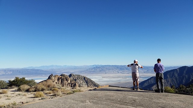
As we drove through the desert on Horseshoe Meadows Road on the way back from our hike to the Ashram, Dave suggested we go up and explore the road (Sue was hoping we would drive this road without her since she isn’t a fan of narrow roads with long drop offs.). It was only mid-afternoon and the sky was clear so up we went! It wasn’t long before we could look back at Horseshoe Meadows Road as it made its way across flat desert from the Alabama Hills towards us.
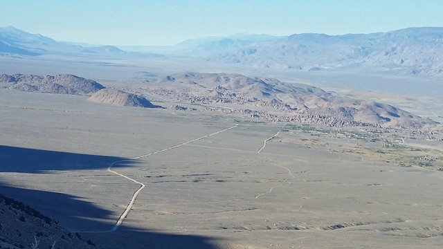
The views as we gained elevation were breathtaking. With the clear, sunny sky we could see for miles to the north and south through the Owens Valley. The Horseshoe Meadow Road is an incredible engineering feat that was constructed for a proposed Disney ski area. When the Wilderness Act was passed in 1964 the ski area concept was abandoned.
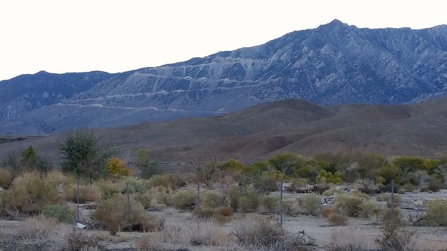
Our home in Boulder Creek RV Park in the distance
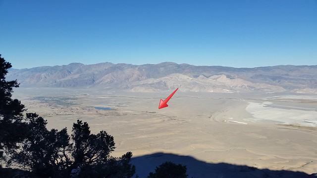
Below us we could see the huge area of Owens Lake. Owens Lake held significant water until 1913 when much of the Owens River was diverted into the Los Angeles Aqueduct, causing Owens Lake to become dry by 1926. Today, some of the flow of the river has been restored and the lake now contains some water. But most of the lake bed is dry and, as of 2013, it is the largest single source of dust pollution in the United States.
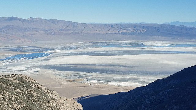
Owens Lake
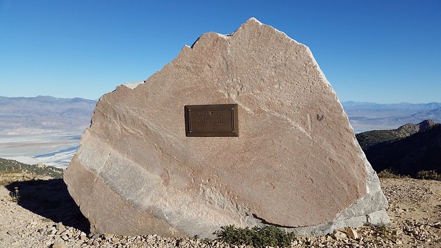
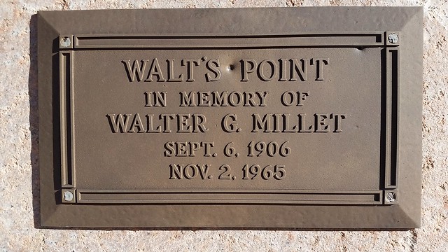
Close to the top is a memorial plaque dedicated to Walter Millet who was an employee of the contractor on the first phase of construction of the road. His job was to fuel the pioneering equipment (bulldozers, air compressors, etc.). Walt was reported to be a very personable and friendly guy and perhaps the favorite of all the men on the project. One day, at about 9,000 feet of elevation, he stepped down off a bulldozer and fell to the ground, dead of a heart attack. The spot is now a famous take off spot for hang gliders and forest service helicopters.
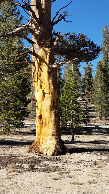
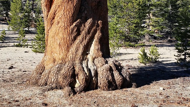
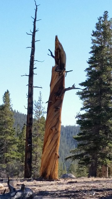
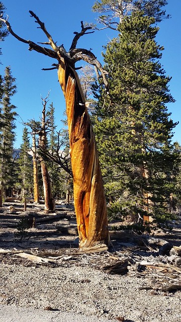
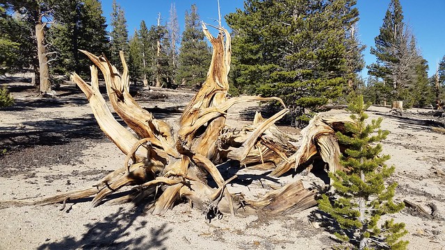
After a drive of fifteen miles and a six thousand foot gain in elevation the road ends at Horseshoe Meadow, a vast meadow 10,000 feet up into the mountains surrounded by lodgepole pine forest. Three campgrounds are located in the Horseshoe Meadow Area. Many of the trees in the meadow look amazing.
There are a number of hiking trails that begin near the campgrounds. But the trails are very long and our time here is short, so we decided to save them for another visit.

Sue and I would get along great. I hate those narrow roads!
Nice tribute to Mr. Millet.
I can’t believe people would drive their RV up to one of the campgrounds. Nuts! I love the trees at the top. Gorgeous. I guess I would have said that the nail biting was worth it.
I know we’d get along well Marsha! I did, finally go up that road with Dave. They all told me it was a nice,wide, paved road and the views were spectacular so I gave in. They were right, although the drive up was not very pleasant for me. I’m glad we went, however, the down journey was much better and the views were unbelievable, as promised. Sue
After all was said and done, I’m glad I finally went. As I said to Marsha, the “up” wasn’t so good for me, white knuckle, leaning toward the middle, gripping the center console, drinking water….but the “down” made it worthwhile. I could relax a bit and enjoy the astonishing perspective only seen from that height. Check that one off the list.
So glad you went up that road! We also looked at it from Boulder Creek and wondered about it, but never made it up there. Thanks for taking us there. What wonderful views!
Guess you win some in the twarting of a Disneyville in such a gorgeous area but then you lose some as in poor Owens river and lake. Not sure I’ve known of any diversion of water or intrusion on rivers that has resulted in unmitigated benefit. Love those gnarly trees. Who can get up there to camp? Tenters/backpackers in a 4WD??
Anyone can make the drive up to the campgrounds. It is a regular wide two lane road with switchbacks to help with the elevation gain. No 4WD needed!
Yep, long trails at high elevation…definitely need to plan those hike days! Thanks for taking me up a road I’ve never been on!
Breathtaking indeed! Maybe……..next time 🙂 Nice tribute to not-Disney-Walt, must have been a heck of a guy!! The Owens Lake fiasco is the gift that just keeps on taking. Love the old trees!
Wow, that is truly disturbing to see the magnitude of what Owens Lake was before Los Angeles sucked it dry. Even worse that it’s now a big dust pollution producer. Geez.
I was shocked to see what has become of Owens Lake. From that vantage point one can see why the dust pollution is so great.
The next day as we were driving down from the Kearsarge Pass we got to witness the dust pollution first hand from above. It was amazing to see the magnitude of the dust blowing and watch how far down the valley it went. I don’t know how the people in Lone Pine stand it.